Monday, September 14, 2026
Ezigrade 4.0.2.177
A rewrite of the export -> Trimble gps file. At the bottom of the dialog we have 2 create buttons. The existing and the new beta version. You can create either or both. Let us know if the beta version fails. Apparently GFX monitors were not showing data around edge of jobs from files created by Ezigrade when the job is rotated on there screen) If this happens on new beta version rerun and re-create with a larger boundary. Please give us feedback if this happens.

Thursday, June 18, 2026
Ezigrade 4.0.2.171
We are working toward a complete solution for exporting to Trimble Civil without Trimble Business Center. We can now create directly CAL, TTM and DXF files. These will load directly on legacy Trimble controllers. However the free Trimble File Flipper will allow you to create SVD/SVL files for later equipment. We will hopefully support SVD/SVL exports shortly.
Tuesday, May 26, 2026
Ezigrade 4.0.2.170
When creating a drain/bank/road profile we now show edges of sections left and right. Also design heights along and at the end of the corridor are also shown as stars. Previously only design heights on other drain center lines were shown.


Thursday, April 30, 2026
Ezigrade 4.0.2.167
Fixed a subtle grid when creating Trimble FMX, TMX files. Inside the FMX file we have a number of columns and grids. There is also an entry for the number of grid points. Rarely this value was calculated incorrectly. In this case the FMX,TMX would not show or use the .gps file.
Friday, March 6, 2026
Ezigrade 4.2.160
We have added in an "Adaptive Grid" data thinning. Very useful for Lidar and other big data sets.
Adaptive grid thinning reduces the number of points in a surface by first overlaying a regular grid across the dataset and selecting a small number of representative points within each grid cell, typically the highest, lowest, and optionally the point nearest the cell centre. Boundary and protected points are always retained. A new triangulated surface is then constructed from this reduced point set and compared with the original surface. Where the vertical difference between the two surfaces exceeds a specified tolerance, additional original points are inserted to improve the local surface representation. This process is repeated in several passes until the surface meets the required accuracy or a maximum number of iterations is reached, resulting in a significantly smaller dataset that preserves the essential geometry of the original terrain.
Thursday, August 28, 2025
Ezigrade 4.2.144
Ezigrade can now import a ".ezigrade" file produced for levelguide. A good check on what you are actally sending out.
Bug in the Haulage arrows fixed. Sometimes it was not doing the whole job.
When doing a grading job with sections hinged together. We now have an option on whether you want all the sections hinged together to try and maintain there cut/fill ratio or simply conform to a common cut/fill ratio for all the sections together. We will add an entry to FAQ's with more details.
Monday, July 14, 2025
Thursday, July 10, 2025
Wednesday, July 9, 2025
Ezigrade 4.2.142
We have migrated the background images from BingMaps to Azure Maps. BingMaps is no longer supported by Microsoft. Legacy Ezigrade programs will still display background images on old jobs; but New jobs will not be able to download background images.
Please download the latest version to keep using background images.
Ezigrade, CDS and .GPS viewer
We have been using Google Bing Maps for background views. Apparently from June 30 2025 Microsoft is no longer supporting BingMaps and the service is now inactive. Thus background maps are either not displayed or have a watermark for the .gps viewer. We are migrating to the equivalent Microsoft Azure maps product. We will let you know when updates are available.
Friday, July 4, 2025
Ezigrade 4.2.141
When doing a pipe design and showing the profile pane. We now display a catchment value. This allows users to check the pipe diameter with online calculators that need the catchment area entered.

Tuesday, July 1, 2025
Ezigrade 4.0.2.119 and CDS 4.2.0.23
The background Bing map now supports transparency. More details in FAQ's.


Monday, June 9, 2025
Wednesday, May 7, 2025
Ezigrade 4.0.2.118
Tile Drainage now recognizes both Single Wall and Double Wall pipes.
Fixed bug in LAS/LAZ imports. There was a bug when filtering points to reduce file sizes.
Tuesday, March 4, 2025
Ezigrade 4.0.2.117
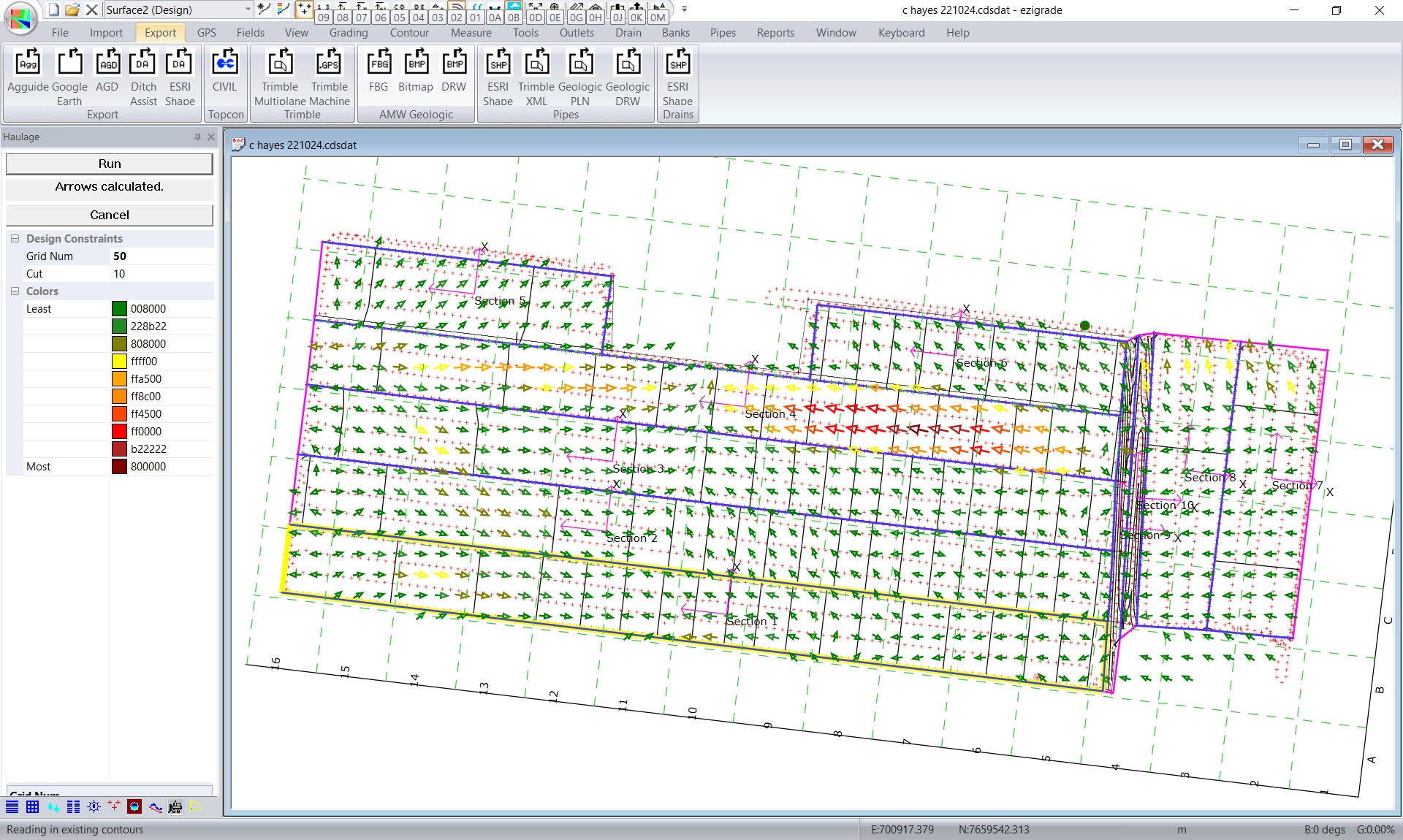
We can now show on the screen and reports, how to optimally move the dirt around the field. A good guide particularly for less experienced operators.

Tuesday, February 25, 2025
Ezigrade 4.0.2.116
When importing a Trimble (.gps) you can now import a .gps file and specify the output units. Previously you couold only import in the same units that the Trimble .gps was defined in.
You can now export the catchment areas to Google Earth:

Wednesday, February 19, 2025
Tuesday, February 18, 2025
CDS 4.2.0.17
Contour annotation was not being exported to a dwg/dxf. Now fixed.
We now implement a rolling backup system. When a job is saved we create 3 extra files. For example if we have a job.cdsdat then on a file save we have the following three files:
(1) job_backup1.cdsdat
(2) job_backup2.cdsdat
(3) job_backup3.cdsdat
File (1)1 is a copy of existing database. (2) is the last and (3) is the one before that.
Thursday, January 30, 2025
Ezigrade 4.0.2.108
Pipe module.
(1) We can specify a minimum default pipe size for mains, submains or laterals.
(2) Pipe - report. We now report a 3d distance. Before we reported the ground distance.
Subscribe to:
Posts (Atom)